
Art, Gold & Silver, Primitives & Rare Books
Lot 229:
Description
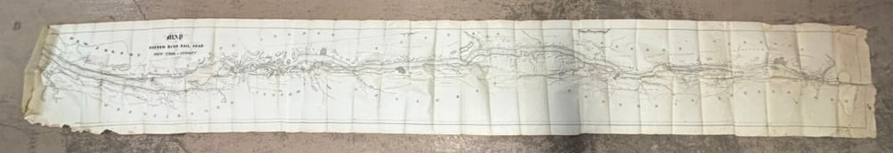
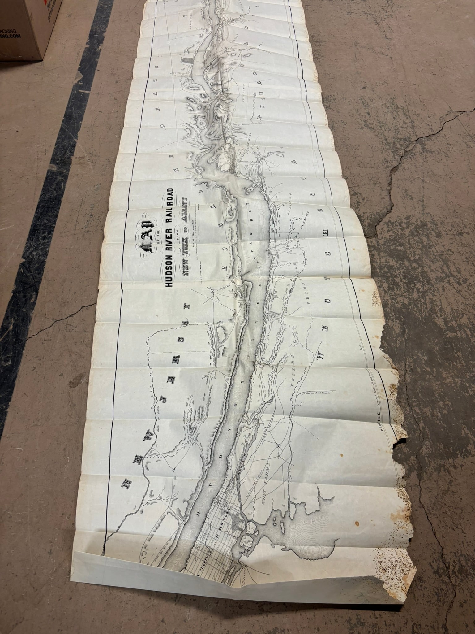
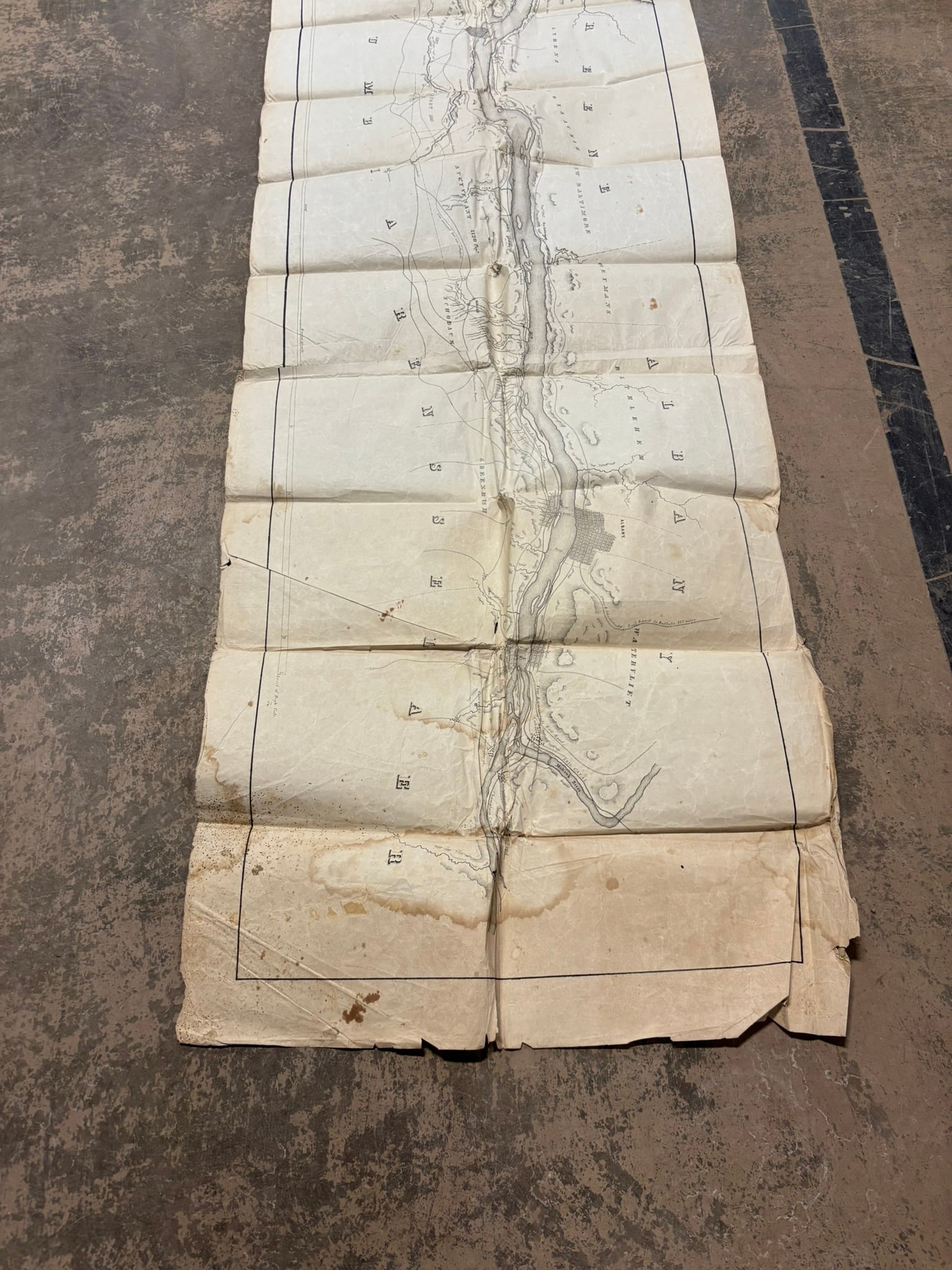
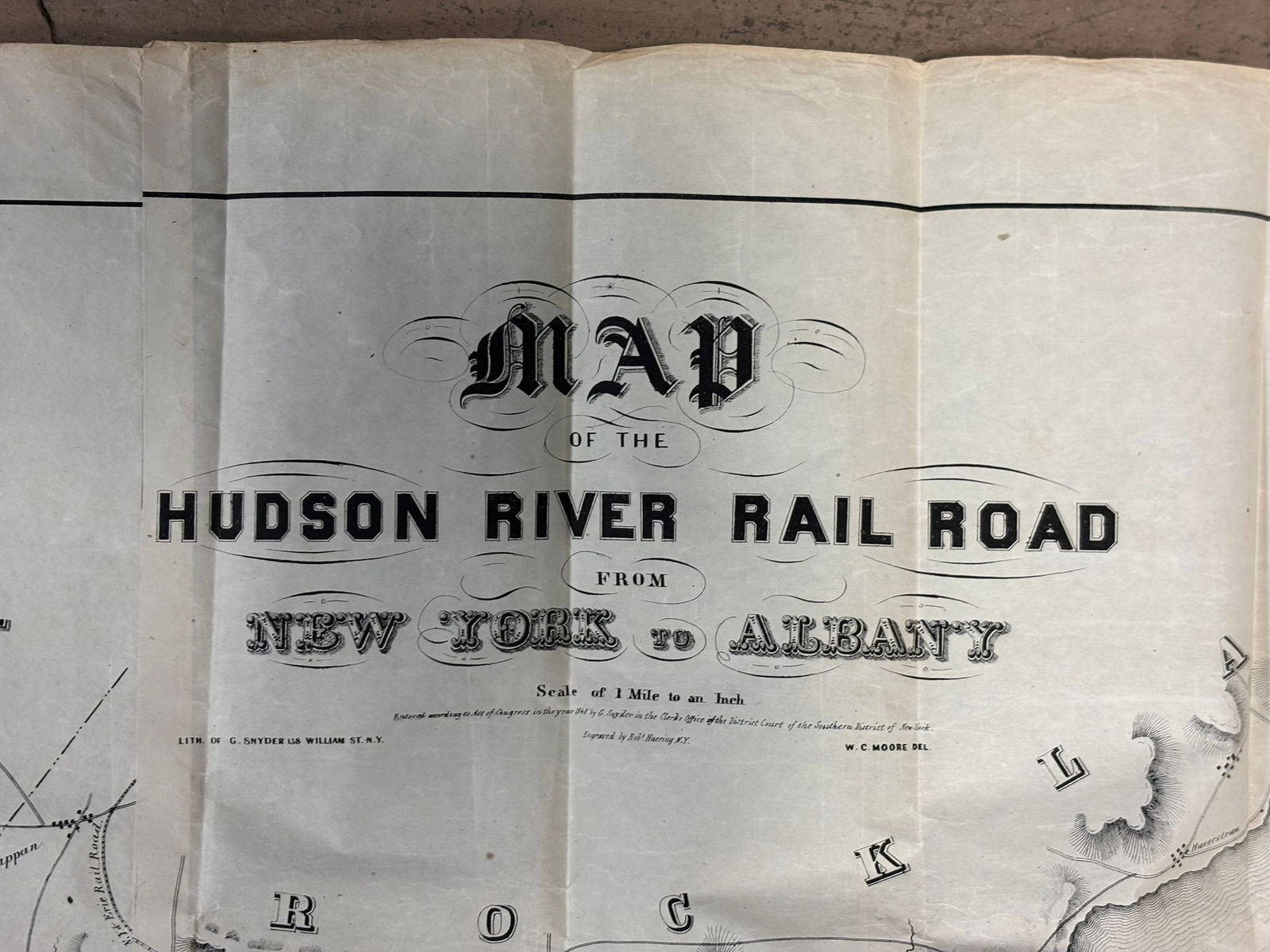
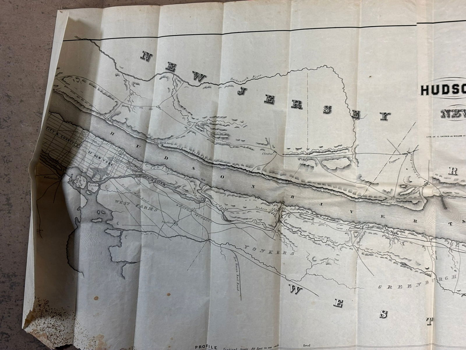
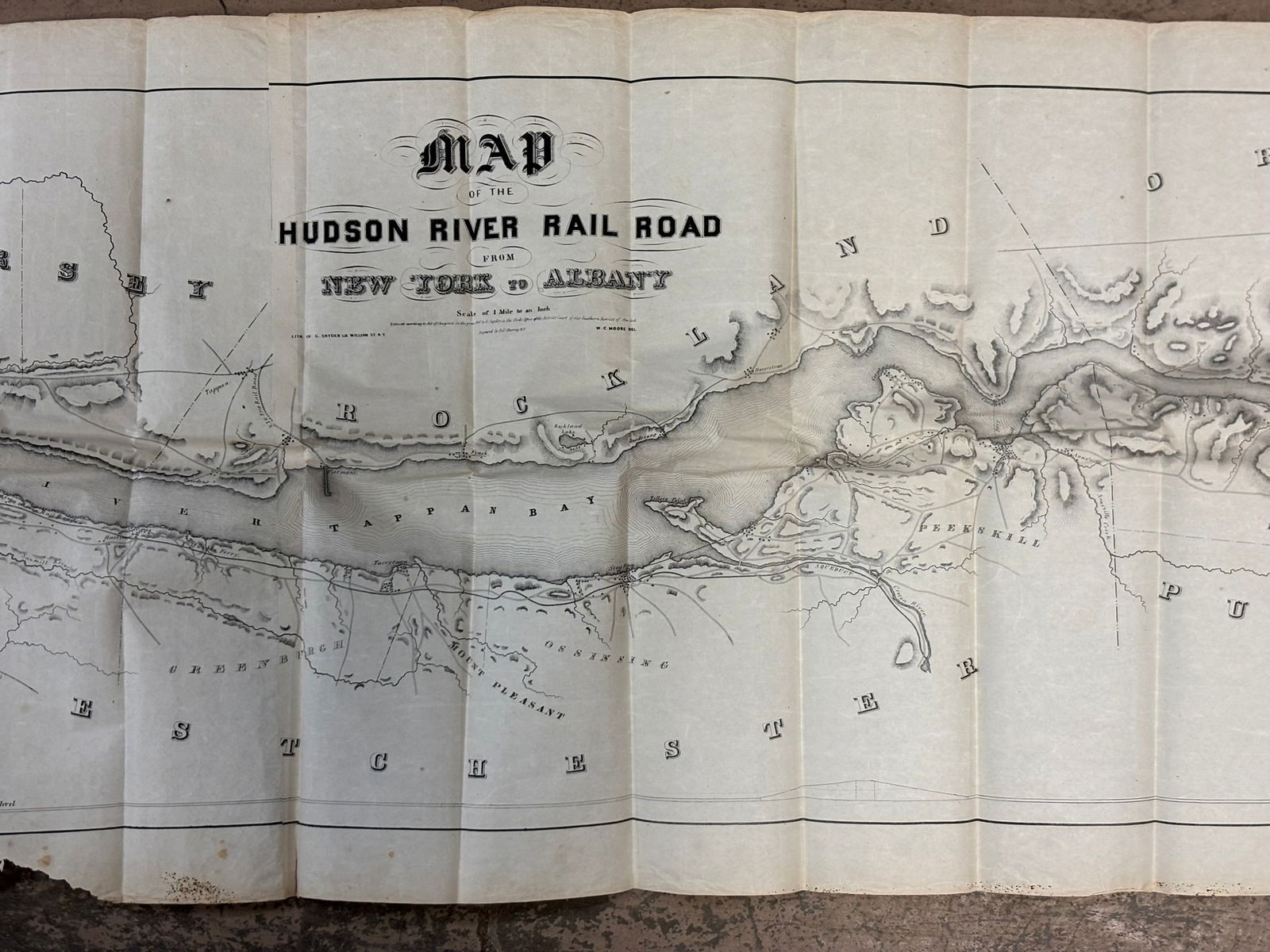
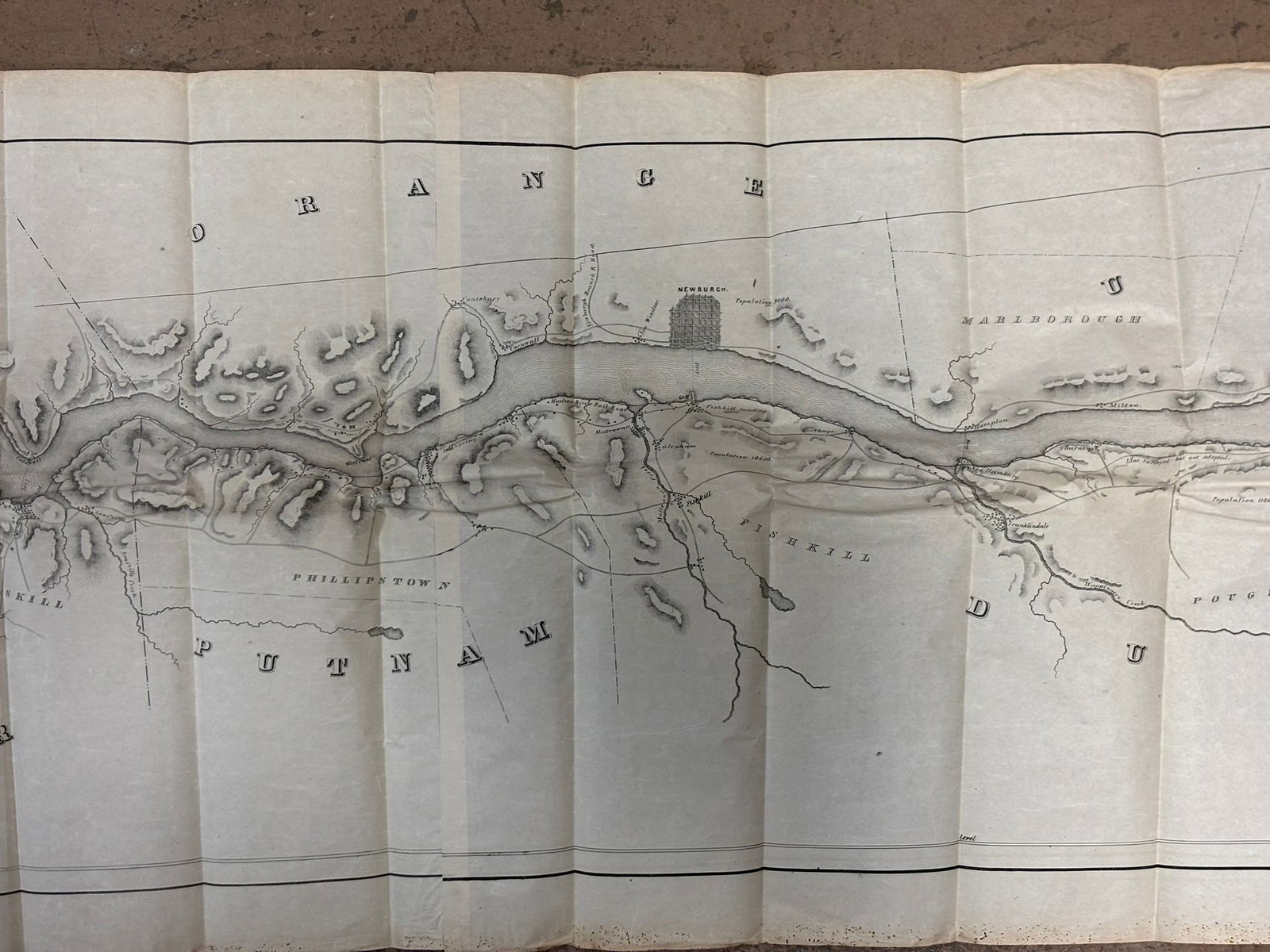
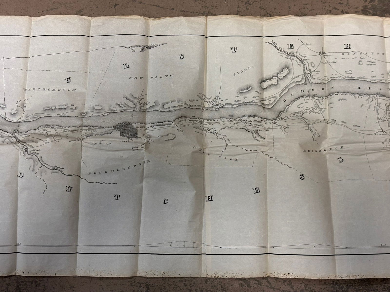
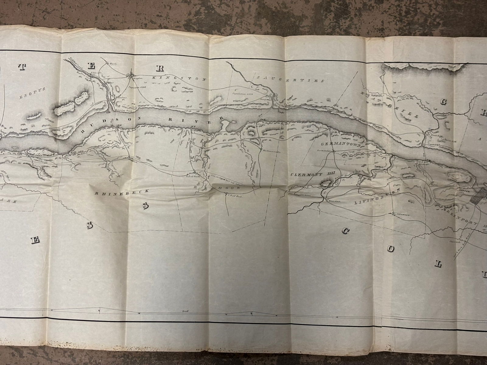
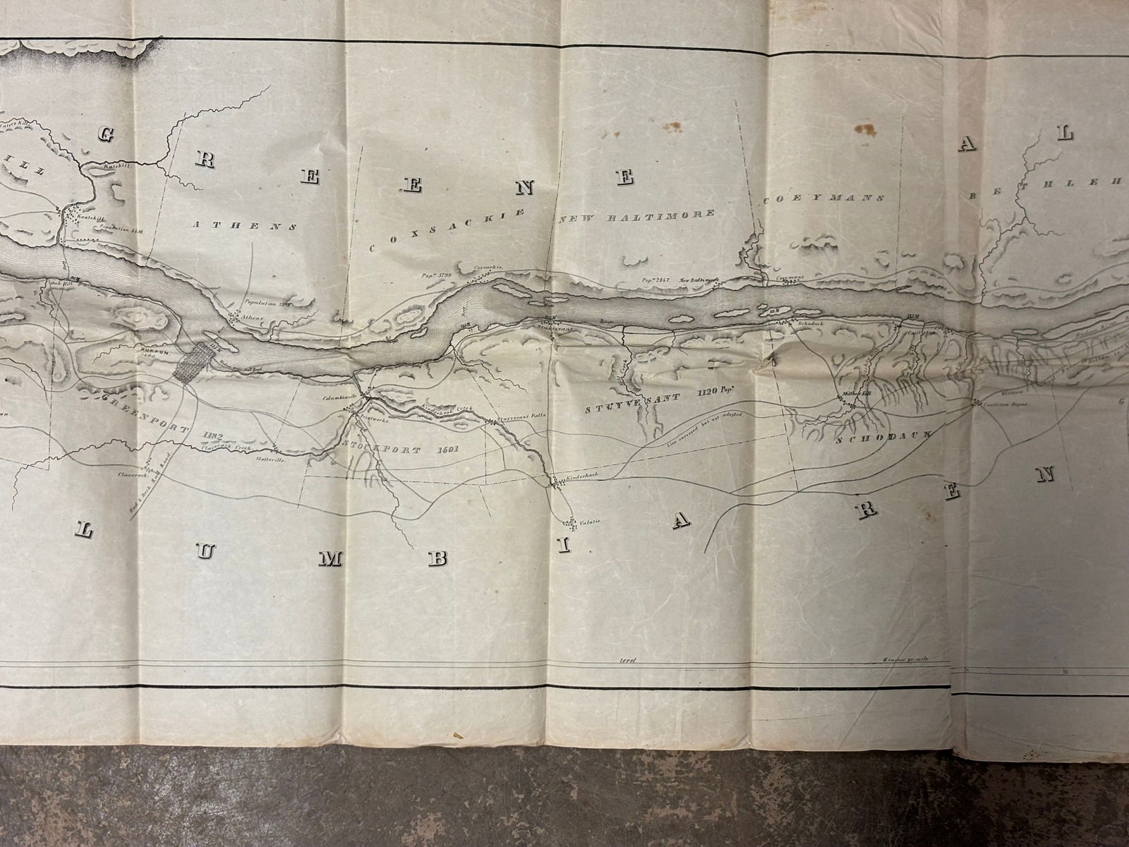
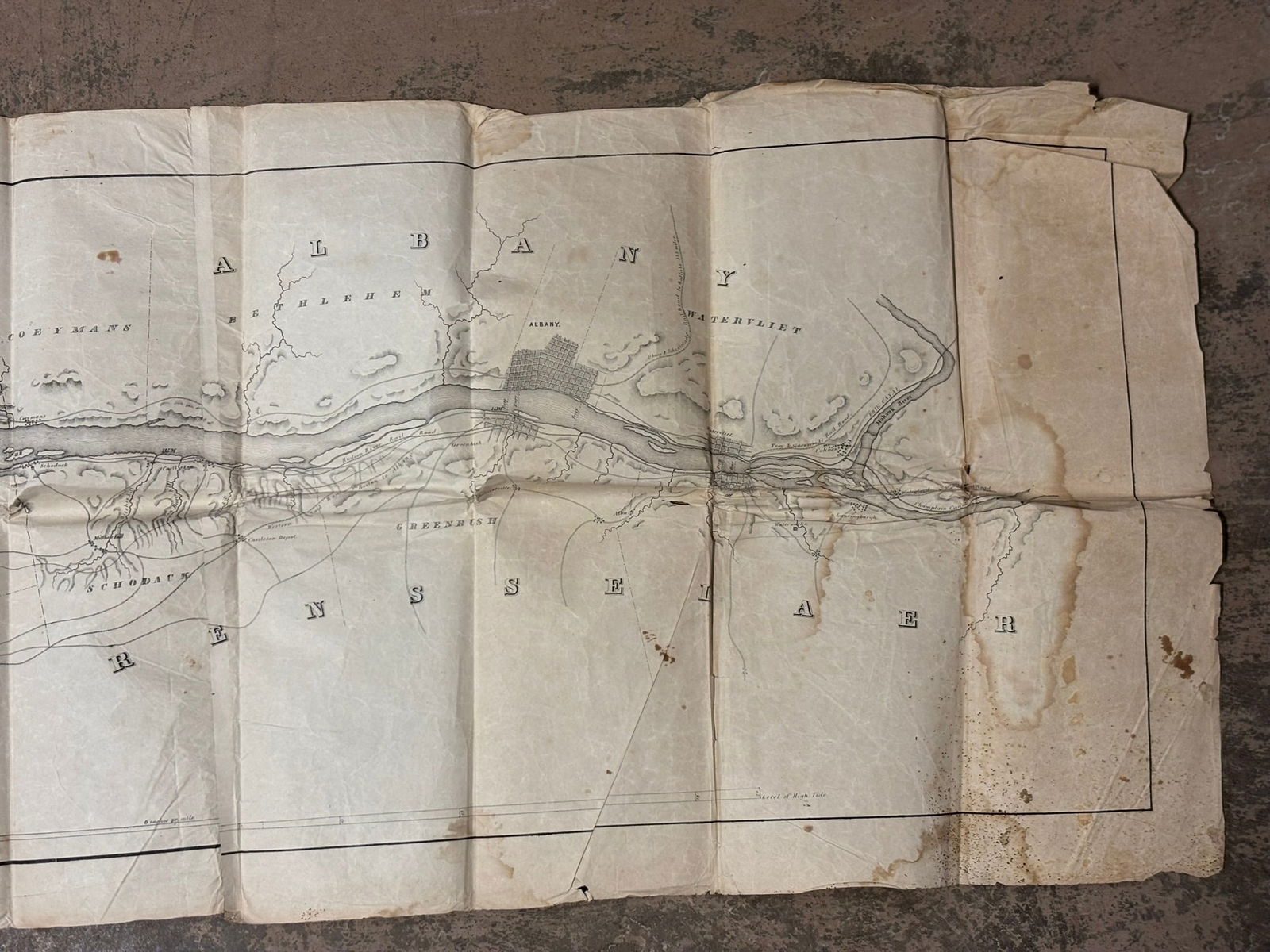
Large mid-19th century lithographed railroad map titled “Map of the Hudson River Rail Road from New York to Albany, ” illustrating the Hudson River corridor from Manhattan northward through Westchester, Rockland, Orange, Dutchess, Columbia, and Albany counties. The map was lithographed by G. Snyder, 138 William Street, New York and drawn by W. C. Moore, with the scale noted as 1 mile to an inch and copyright entered in the Clerk’s Office of the U.S. District Court for the Southern District of New York. Measuring approximately 146 x 19.5 inches when fully unfolded, the map provides a detailed cartographic profile of the Hudson River valley including towns, rail alignments, river islands, elevations, and geographic features along the developing Hudson River Railroad corridor. Locations visible include New York City, Yob4323ers, Tarrytown, Peekskill, Newburgh, Rhinebeck, Germantown, Coxsackie, and Albany, with the Hudson River and surrounding terrain carefully engraved in period railroad survey style. Condition shows expected wear including fold lines, edge losses, staining, and toning consistent with age and storage, but the map remains an impressive early railroad-era document illustrating one of the most important transportation routes in New York State during the expansion of American rail infrastructure.
Share this lot: