
Art, Gold & Silver, Primitives & Rare Books
Lot 219:
Description
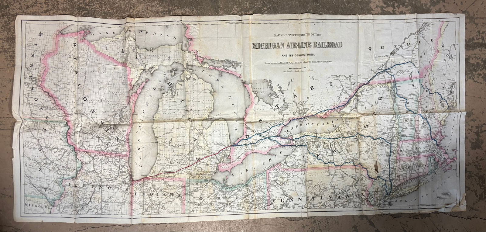
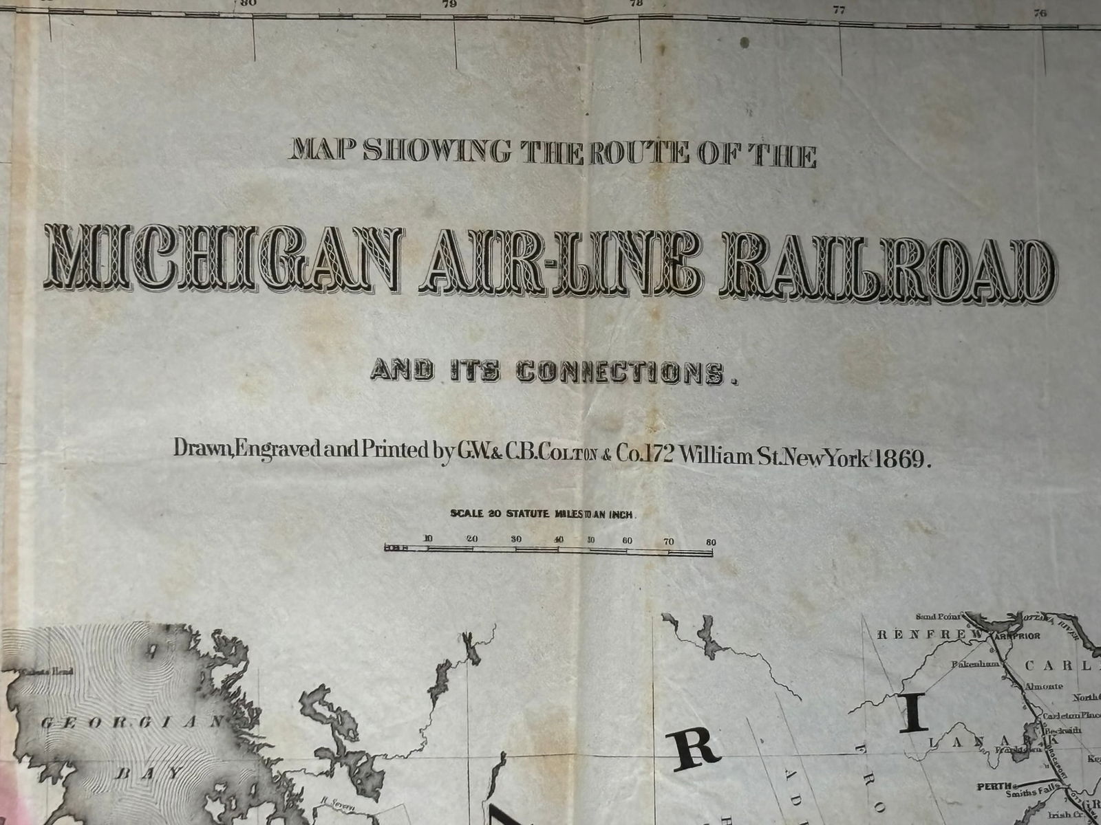
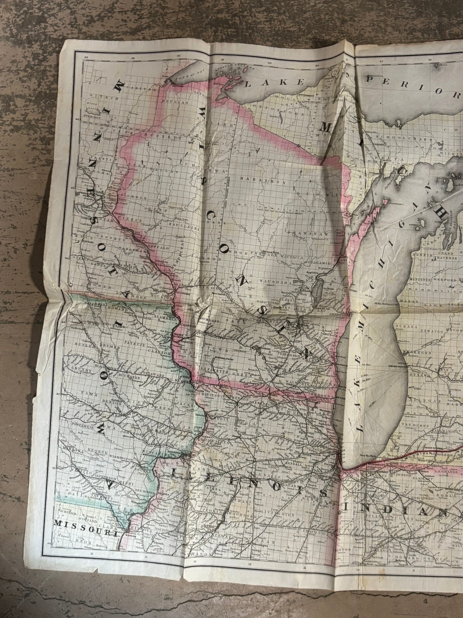
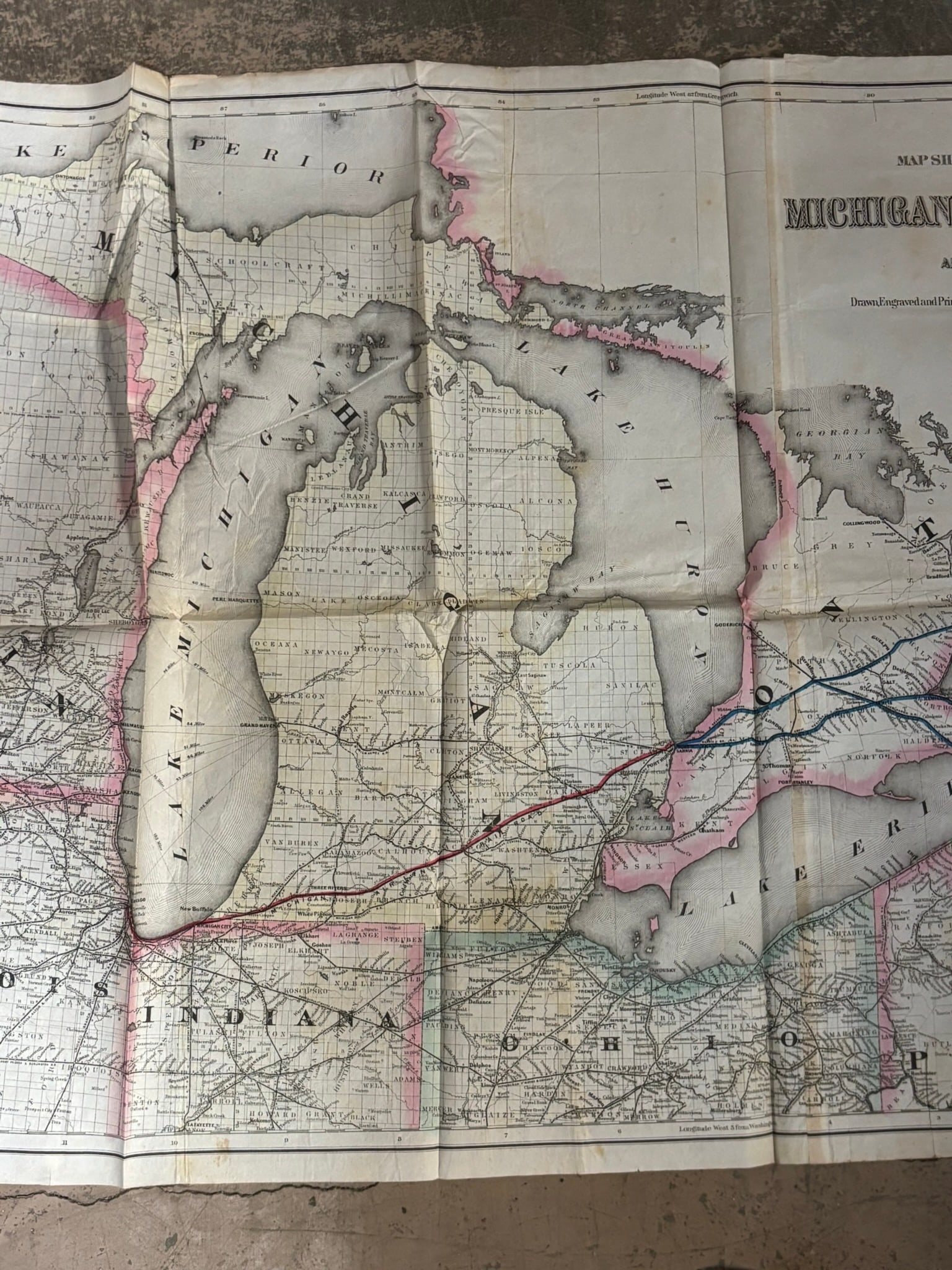
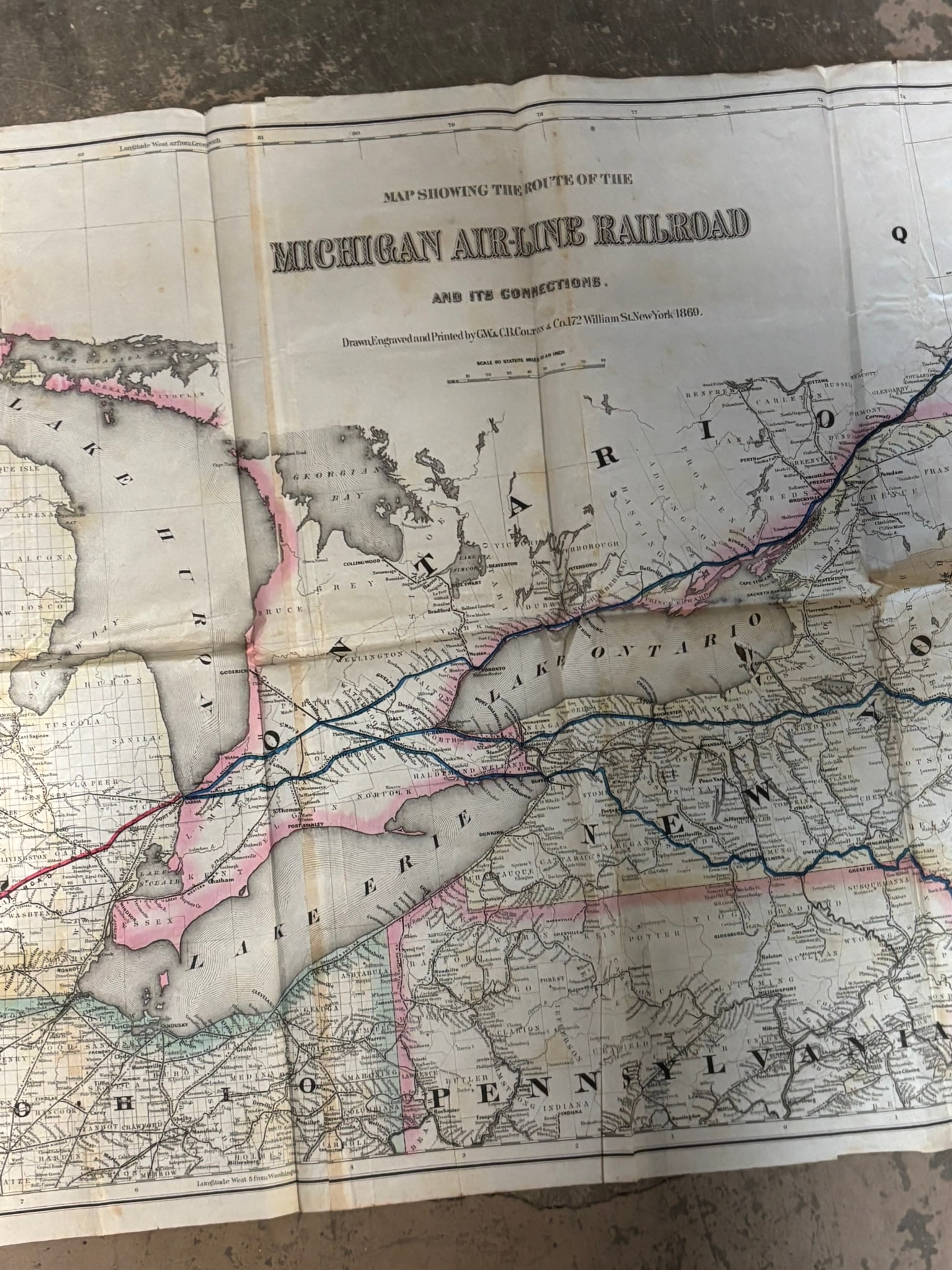
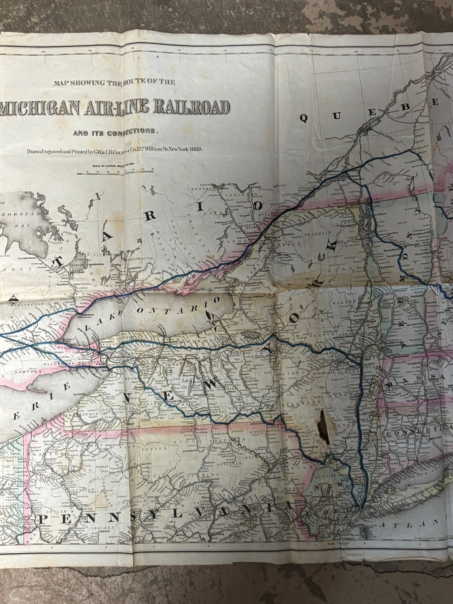
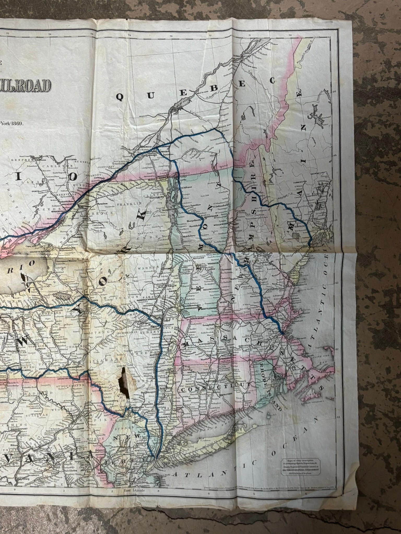
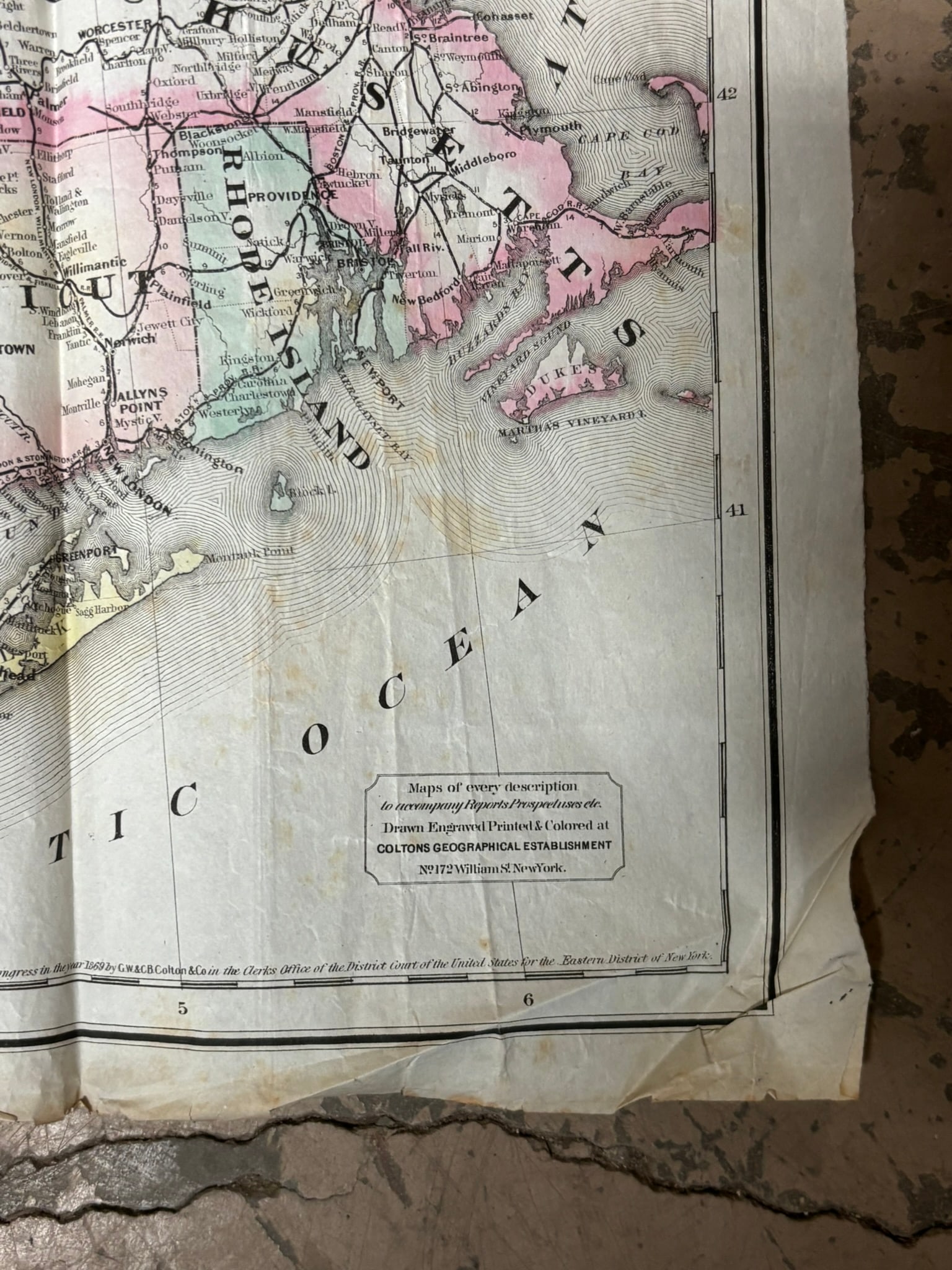
Large 19th century folding railroad map titled “Map Showing the Route of the Michigan Air-Line Railroad and Its Connections, ” drawn, engraved and printed by G.W. & C.B. Colton & Co., 172 William Street, New York, dated 1869. The map illustrates the Great Lakes region including Michigan, Wisconsin, Illinois, Indiana, Ohio, Pennsylvania, New York and portions of Canada with the Michigan Air Line Railroad route highlighted across the region. Detailed county boundaries, rail connections, and waterways are shown throughout including Lakes Superior, Michigan, Huron, Erie and Ontario. Printed with original hand coloring and a scale of twenty statute miles to an inch. The large folding format measures approximately 58 x 25 inches when fully opened. Condition shows expected age wear including fold separations, toning, creasing and minor losses consistent with a working railroad map from the late 19th century.
Share this lot: